
Pontiac ZIP Delivery Types
Pontiac has four ZIP labels in the Michigan reference map, but each plays a different postal role. Three are identified as standard carrier-delivery ZIPs. The fourth is marked as a PO-box-only ZIP, which changes how it should be read in address research. The table gives the verified relationship to Pontiac without inventing neighborhood boundaries that were not supplied in the official materials.
| ZIP | Pontiac relationship | Post office or delivery type | Research note |
|---|---|---|---|
| 48340 | Pontiac delivery area shown on the Michigan ZIP map | Standard carrier delivery | Exact neighborhood boundary was not located; verify the address with USPS |
| 48341 | Pontiac area, including the Oakland County government campus example | Standard carrier delivery | Institutional and county-campus addresses use this ZIP |
| 48342 | Central Pontiac examples include North Saginaw and North Perry | Standard carrier delivery | Official downtown and civic examples use this ZIP |
| 48343 | Pontiac postal label associated with the W. Huron post office | PO-box-only indicator on the state map | Not a normal residential carrier ZCTA in the Census search |
The state map is a reference, not an address-boundary survey. Census geography for Pontiac includes ZCTA products for 48340, 48341, and 48342, while 48343 does not appear as a fully or partly represented residential ZCTA. That result supports the map’s PO-box warning, but USPS remains the source for confirming any one delivery address.
Search Pontiac ZIP Areas by Address
A ZIP code directory works best as an address-verification path, not as a ZIP-wide resident roll. Pontiac’s parcel interface accepts an address or PIN, not a visible ZIP filter. The city’s BS&A material identifies name, address, and parcel searching, but does not document a ZIP control. Michigan’s Qualified Voter File request uses geographic categories such as county, jurisdiction, district, school, village, ward, and precinct, not ZIP. Convert a postal result into a precise address before using property, permit, or public-record channels.
- Use USPS with the street address, city, and Michigan selected to verify the delivery ZIP and any ZIP+4 context.
- Search the Pontiac address or PIN in Oakland County Property Gateway to identify the parcel and physical municipality.
- Use the Property Gateway map or county postal-area layer for geographic context, keeping in mind that a public ZIP export or filter was not documented.
- If public voter data is genuinely needed, use the formal state request route by one of its listed geographic scopes, not a claimed ZIP search.
- Once a ZIP result has narrowed the location, use the address itself for the full Pontiac Street Directory record trail.
The distinction saves time. A postal ZIP identifies an address’s mailing geography, while a PIN and legal description connect that address to the county land-record system.
Verify a Pontiac ZIP With USPS
USPS Postal Lookup is the authority for an individual mailing address. It offers address, city-and-state, and ZIP-to-city modes. A specific street address is the strongest starting input when the goal is to confirm a delivery ZIP. USPS also notes that its standardized mailing form can differ from a local address convention, so retain the form returned by the postal service when preparing a search.
| USPS control | Input | What it returns or supports | Use for Pontiac |
|---|---|---|---|
| Find by Address | Street address, city, state | ZIP for a standardized address | Confirm one Pontiac delivery location |
| Find by City and State | City and state | ZIPs associated with the city | Review Pontiac’s postal labels |
| Cities by ZIP Code | Five-digit ZIP or ZIP+4 context | Associated city names | Check a ZIP’s postal association |
| Search | Required action | Executes the chosen lookup | Use after completing the selected mode |
The Pontiac Post Office is listed at 735 W. Huron Street, Pontiac, MI 48343-9998, with 248-454-2413 as its phone number. USPS lists retail hours of Monday through Friday 9–6 and Saturday 10–2. ZIP+4 adds delivery-route precision, but it does not change the parcel or municipal boundary.
The USPS Pontiac lookup interface provides the address and city-state modes used to confirm postal ZIP information.
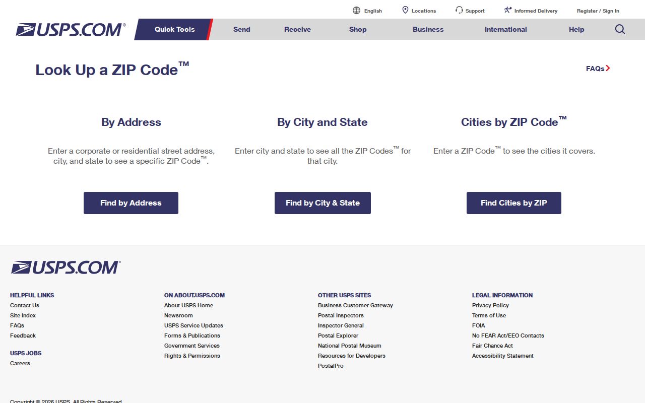
Use the USPS result as the postal check, then rely on parcel tools for the physical location and record identifiers.
Pontiac ZIP Postal Map Layers
Oakland County Mapping Services describes Property Gateway map products with parcel boundaries, aerial imagery, elevation, FEMA flood information, and related geographic layers. The county enterprise GIS service also includes a postal-area layer. That layer can help compare postal geography with a known parcel, but the research did not find an official public ZIP filter or export inside the Property Gateway landing search.
For a ZIP code directory search, map navigation is therefore an inspection tool rather than a bulk query. Search a known address or PIN, open the map, and compare the parcel’s municipality with the delivery ZIP confirmed by USPS. Basic navigation may be free, while reports and maps can use purchase paths. The county cautions that data comes from multiple municipalities and can be classified or updated differently.
Note: A map layer offers geographic context, but no documented Pontiac portal turns one ZIP into a complete public resident list.
Pontiac ZIP Postal Geography
Pontiac’s postal geography is layered. County campus addresses use 48341. Downtown Saginaw and Perry examples use 48342. The city also has carrier-delivery 48340 and the W. Huron post-office label 48343-9998. These labels help route mail, yet none alone resolves the city boundary, legal parcel, or neighborhood identity. That is why a Pontiac ZIP code directory should be read alongside a physical address and, when property research is needed, the PIN and legal description.
The zoning context places Pontiac against Auburn Hills, Lake Angelus, Waterford Township, and Bloomfield Township. A Pontiac mailing city or ZIP can serve an institutional or nearby municipal address, and a physical Pontiac address can use a neighboring postal-city convention. This is a geography question, not a signal to assume that every matching postal label is inside the same jurisdiction.
Pontiac ZIP Address Parts
Four address terms answer different questions in Pontiac record work. Keep them separate when a postal result needs to connect to a parcel or deed. The county does not provide a published decoding guide for the digits in a PIN, so it should be treated as an opaque parcel identifier rather than a ZIP-like code.
- ZIP
- A postal delivery area used by the mail system. It does not draw a municipal or parcel boundary.
- ZIP+4
- An added four-digit delivery-route precision used with a five-digit ZIP. The Pontiac post-office example uses the 9998 context.
- PO-box ZIP
- A postal ZIP associated with post-office boxes rather than a normal carrier-delivery area, as the 48343 map warning indicates.
- Carrier route
- A mail-delivery route within postal geography. It is not the same thing as a neighborhood, city limit, or parcel.
- PIN
- The county parcel identification number used to find a property in Gateway and connect its physical address to land records.
Legal descriptions serve another function. A lot, block, subdivision, condominium unit, or metes-and-bounds description links a Pontiac address to title records when street formatting is unclear.
Pontiac ZIP Search Limits
Property Gateway accepts address or PIN input, with partial and wildcard formats, rather than a visible ZIP control. Pontiac BS&A may be searched by name, address, or parcel number, but official static instructions did not locate a ZIP filter. The Qualified Voter File request offers government and election geographies, not a ZIP field. Those limits mean that an accurate ZIP result is a starting point for an address search, not a replacement for it.
Michigan.gov/Vote remains a personal registration-status and clerk-information service. It is not a ZIP lookup. Formal voter-data requests also withhold protected fields, including driver or state ID information, month and day of birth, phone, email, signatures, SSN4, and Address Confidentiality Program material. Postal geography should never be used to bypass privacy safeguards.
Pontiac ZIP Boundary Limits
ZIP boundaries and Pontiac city limits are not the same kind of boundary. A postal city and ZIP can include institutional or adjacent municipal addresses. Conversely, an address physically within Pontiac can carry a postal convention that points to a nearby city. Verify the physical municipality through GIS or the parcel record and verify the postal city and ZIP through USPS. That two-part check prevents a postal label from being mistaken for a jurisdiction.
Pontiac ZIP Change Gap
No official Pontiac ZIP split or realignment year was located in the research. Older directories may use address formats, telephone exchanges, or municipal labels that do not line up neatly with current postal practice. When an older entry conflicts with a modern ZIP result, preserve the historical street name and number, compare neighboring entries, and use the legal description or parcel history where available rather than assigning a change date without documentation. A dated directory entry, parcel record, and USPS check can explain the mismatch without turning an uncertain change into a fact.
Note: Postal geography can change independently from street names and parcel descriptions, so each record should be read in its own date context.